After hiking Hayes and eating some dinner, the stomach pain
from my unfortunate lunch had mostly receded.
Prior to the hike, my husband removed the third row of seats out of my
car turning the back into a full size bed.
Ready for an overnight in my car, I drove to Success Pond Road with the
intention of sleeping at the Mt. Success trailhead. Just a
few miles into the drive, a large deer jumped directly in front of my car. I
thought it best to turn around and sleep at the Success Trail ATV parking
area. I drifted off to sleep to the
sound of ATV’s zooming around me and the snores of my chihuahua.
I let myself sleep until 7:00. Feeling much better, I let the ERD out and
checked out my surroundings. Lots of
bullet holes in the Success ATV sign…glad I didn’t notice that last night.
Success Pond Road was much better than I anticipated. It was a well maintained dirt road and there
were signs at the ATV parking area advertising it as through-road from Berlin
to Grafton. That being said, the turnoff
to the Mount Success Trailhead was not well maintained. Having been stuck for 5 hours with my kids a
few years back, I could feel my lungs constrict as I started down this
road. When I reached the small
‘official’ parking area, I decided to continue down the road to the big field
(the second parking area) I had read about in other blogs. This is a heart-pumping narrow road with a
large rise in the middle just aching for a chassis to get stuck on it. I drove up onto the rise tilting my sequoia a
good 30 degrees just to keep my car from getting stuck. I arrived at the field and what do I
see? A small Honda CRV from Ohio!!!
What? This little car has low
clearance and the wheels are on the same axle!
I can’t for the life of me figure out how Mr. Ohio got to the
trailhead. Apparently, if you are a
person who has a small car and daredevil
personality, I say go for it.
Before you get to the difficult section of the road :)
The trail is rated difficult/very difficult on Franklinsites
and as I hiked up I couldn’t figure out why.
I thought it was a moderate hike and it felt like a gradual ascent. On the way down however, I thought “Who the
heck climbed this mountain? It couldn’t
have been me?” It seemed like an endlessly steep descent. There were a number
of sections of slippery rock face covered with a thin layer of moss, two small
scrambles (one I had to help the ERD get up and down) near the summit. The trail was pretty eroded at 2900
feet. I recommend being careful on the
cut log pathways. They are slippery and I
did an involuntary split on one of them.
There were a few muddy sections between the log pathways, be careful not
to step in them. I tested the depth in
one section with my hiking pole and it was surprisingly 2 feet deep!
Don’t miss the Outlook path!
It is has stunning views and a nice ledge walk back to the trail. Note: As you continue hiking toward the summit, you
will come to a fork in the trail, stay right on the ‘blue blazed trail’.
The Mt. Success summit was beautiful with views all
around. I called my husband to let him
know I was still alive and he reminded me his cousin from Italy was visiting
and we are going to dinner. I completely
forgot. Ugh..
I quickly set off to look for the plane crash. I crossed the
log pathway through the field but didn’t know where to go from there. Was it off of the main path? Was it one of the small narrow, overgrown
foot paths. I had no idea. There weren’t any details in anything I
read. I chose the main path down the
mountain. Using my GPS, I got as close
as 300 feet but the main path veered away from the site. I decided to bushwhack through the
woods. It was the thickest bushwhack I
have ever done. It was so thick I thought
I may not get out alive and my bones would be discovered years later tangled up
in the tree branches. I got as close as
100 feet but couldn’t see any way of getting closer. Forty five minutes had passed, I was going to
be late for dinner. My (mostly) patient
husband (who on a daily basis wonders why I do these things) would not be
happy. So I bushwhacked back up to the
summit. I emerged covered with small
branches, pine needles and a few spiders. Disappointed, I headed back down the trail.
About 10 minutes from the parking lot I see two friends and
their pooches heading up the trail. I
tell them of my failed attempt to the crash site. ‘Oh, didn’t you know there are markers
leading you down to the crash site?”
Groan…
Well it gives me a reason to go back.
39 (52WAVs) down 13 to go.
Early morning drive on Success Pond Road to the trailhead
I hate hiking in the dark.
I don’t mind hiking at night through woods I know and enjoy spending time
seeking out owls and documenting vernal pool species. However, the thought of hiking a mountain
trail at night, in unfamiliar woods alone, gives me nightmares.
After class I drove the three hours toward Hayes. I decided on the longer, but easier to find,
Centennial Trail. Too worried about the
time to get a decent lunch, I opted for McDonalds. They did away with the grilled chicken salads
long ago, so I ordered a quarter-pounder meal.
A mistake. Twenty minutes later I had stomach pains that would kill a
mule. Ugh. They will subside before I get to the
trailhead…NOT.
I get to the trail, I’m in pain, my face is sweating and I’m
sure it’s the color of moss. Hiking will
make my stomach feel better…NOT. I take
two hiking sticks instead of my usual one-stick somehow thinking it would be better
to hike with two sticks with a stomachache.
The extra stick just annoys me so I hide it behind a fallen birch tree
and continue up slowly. I make my way up
the steep trail, in the heat, with a stomachache and a green face. The three mile ascent felt like the longest
hike in history. As I neared the first
set of ledges I met an older couple on their way down. They looked at my green face queerly. I had to explain my green face to them. They said I shouldn’t eat McDonalds ever
again.
I know the summit is not well marked so I continued on and
on past a few more less attractive ledges, through mossy paths (matching my
face) until the trail markers changed colors and continued until I dropped 300
hundred feet in elevation making sure I hit the summit.
When I hiked back to the first set of ledges there was a couple
of hikers there sitting where I wanted to have a snack, smoking
cigarettes. My first thought in my
grumpy, green-faced state was, “They’re sitting in my spot and they are smoking
cigarettes! How can hikers smoke cigarettes?!” Then I realized after a strong wave of nausea hit
me; “Who am I to judge? I ate McDonalds for lunch!” So I started up a conversation. These very nice guys were thru-hikers who
only had 300 hundred miles left of the Appalachian trail to hike. We talked a little about their adventure and
their final destination, Katahdin.
After they headed on, I started my descent back down the
trail. Surprisingly it was still light
and I was excited I was going to be back at the car before dark. Then I
realized I had to find my husband’s hiking stick I left behind a random
fallen birch log. What I realized on the
descent is every fallen birch log looks the same as the next one. After looking behind what felt like a 100
logs I realized I wasn’t going to be back before dark. In fact, night had fallen so quickly I found
myself standing in the dark. But before
the fear could creep in, something wonderful happened. Gray treefrogs started
calling from the treetops. As I listened to the treefrogs, I noticed the walking stick under a
dead oak…not a birch. Haaa :).
Back at the car, I found myself looking forward to the next day’s
hike - Mt. Success.
Finally a beautiful day for a hike, no rain today! Phew!
The
trailhead was a little tricky to find. There is a small sign that's difficult to see from the road and of course I missed it: twice.
I stopped to ask for directions and drove into
a large lot that looked like a small logging operation. The first thing I see is a car on top of a
tower of logs. I knocked on all of the
doors of the building. I was no longer
interested in directions, now I wanted
to know why there was a car on top of a log tower J. Unfortunately, I didn’t get to meet the interesting
characters that own this place.
The trailhead is located in Harts Location on the south side
of Rt 302 a ½ mile west of Sawyer Rock Picnic area. If you see the sign the “Entering Bartlett” you’ve gone too far!
The Tremont trail is beautiful. It follows along Stony Brook for a while; the water is crystal clear with an emerald
green hue and many minor cascades. Around the 1.5 mile point the switchbacks
start. I enjoy scrambles and bouldering. Switchbacks are an endless, monotonous, butt-kicking, trail
to a lobotomy. Give me loose shale and
scrambles any day, at least they keep my mind alive ;).
American Bald Eagle
I was so happy when I finally reached the summit. The summit was definitely worth the mind-numbing
switchbacks. I invited a yogini friend and of course we had to have some yoga play on the summit. We basked in the
warm sun, watched a bald eagle soar above us, and we were very reluctant to head
back down.
I’m going to miss summer.
37 down 15 52-WAVs to go.
Angel wings - oyster mushroom look-a-like. Edibility uncertain. Many eat it, however there has been 2 deaths associated with them. Best not to eat them.
The mountain weather forecast read – mix of sun and clouds,
chance of rain with precipitation of .01 to .02 inches. Looked like a nice day for a hike. I needed something reasonably close so I
decided on a second attempt at Paugus after a hell hike last spring. Since
it was supposed to be a nice day I thought I would head up Cabin to Lawrence
and head down Old Paugus to Big Rock Cave.
I even thought about hiking to the true summit like my cyber hiking
friend Rhonda. I was looking forward to
a peaceful, pleasant hike.
An hour and a half into my drive it starts pouring…not sprinkling,
not raining, but can’t-see-through-the-windshield pouring! I pulled over to check several different
forecasts, none said steady rain, most said mix of sun and clouds… I continued on.
I get to the trailhead and it’s still pouring. Ever the optimist I think, “No problem. It
will probably clear up by the time I get to the summit.” Haaaa.
The last time I attempted Paugus, I left covered in
scratches and black fly bites. Unlike like
the Big Rock Cave Trail and Old Paugus Trail, the Cabin & Lawrence trails
are well maintained. Even though the
trail was overrun in some places, it was well traveled and easy to
follow.
By the time I got to the Lawrence Trail the rain was so
heavy I couldn’t see through my glasses and I had to accept the fact there was
no chance of clearing. This part of the trail has many switchbacks giving you the
false impression you are almost at the top.
I didn’t want to keep pulling out my map in the rain so I just kept going. I looked at my 10 lb chihuahua blindly following
me without question in this miserable cold, wet weather and realized, at that
moment, he is the only one in my life who would ever put up with this! It made me love the little guy a little more.
I finally made it to the South Peak summit! From what I could see in the rain, it looks
like a nice place to hang out in good weather.
I guess I will have to hike it a third time.
The rain continued as I headed back down, the skies
darkened and it felt a little claustrophobic in the deep woods. I got a brief stab of the “Friday the 13th”
heebie-jeebies on an exceptionally dark section of the woods, but it left as
quickly as it came when I spotted some lovely edible mushrooms.
I can’t say a really enjoyed hiking 5 hours in pouring,
bone-chilling rain, but all and all, I thought it was a beautiful trail and will
hike it again on a better day.
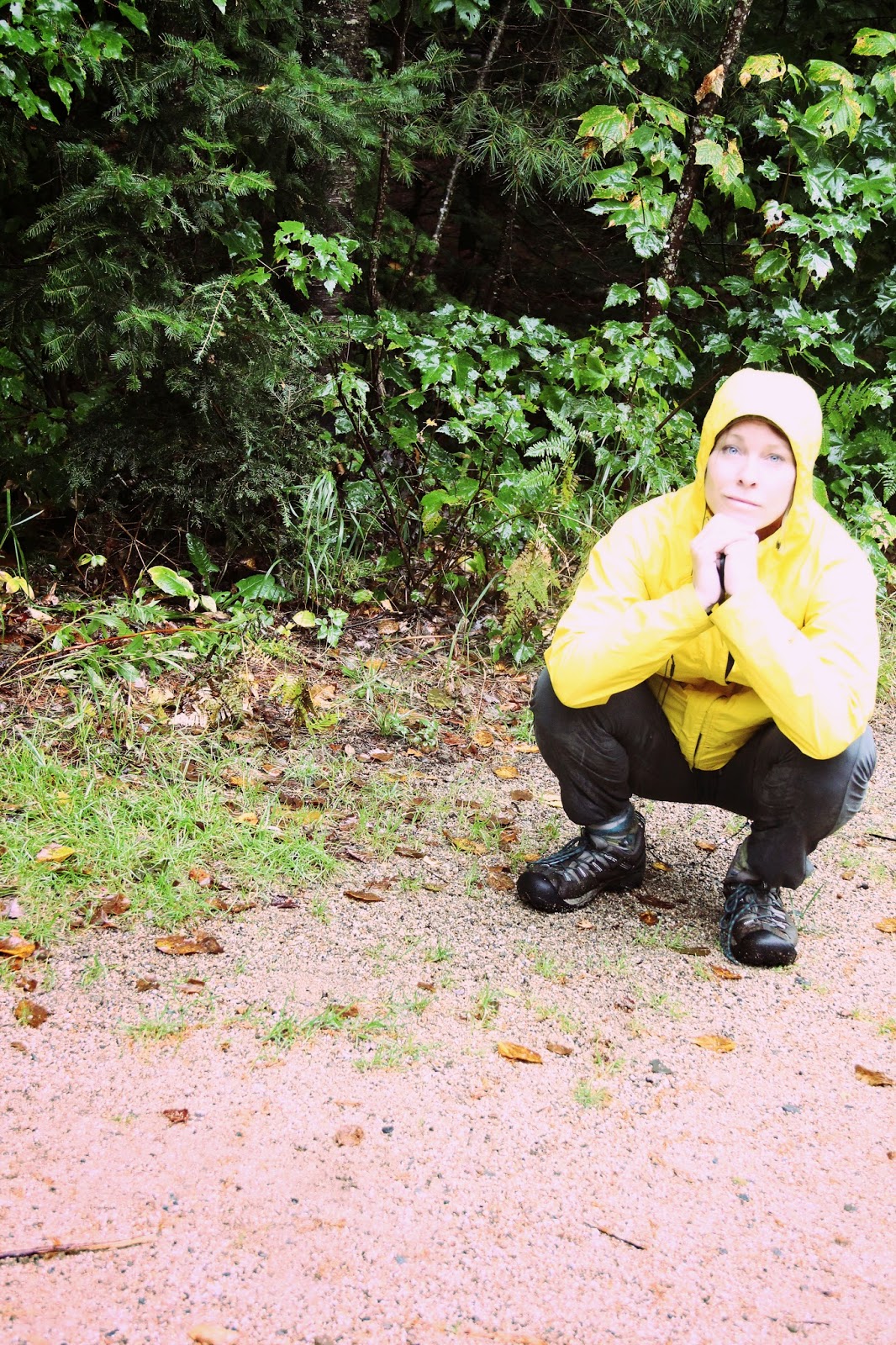
Survived the rain :)
H. coralloides -Comb Tooth left. The one on the right (and back left ) is H. americanum - Lion's mane


