Monday, September 8, 2014

Sibling adventure: South and North Doublehead and Black Mountain Middle Peak

I asked my brother to join me on this overnight trip.  We have only seen each other twice in 10 years and I knew it would be a good way to reconnect.    

I pulled my pack together taking everything I would need for an overnight hike.  My pack, on average, weighs between 15 - 20 lbs, today it weighed 30 lbs including 86 ounces of water for myself and the ERD (my Chihuahua). 
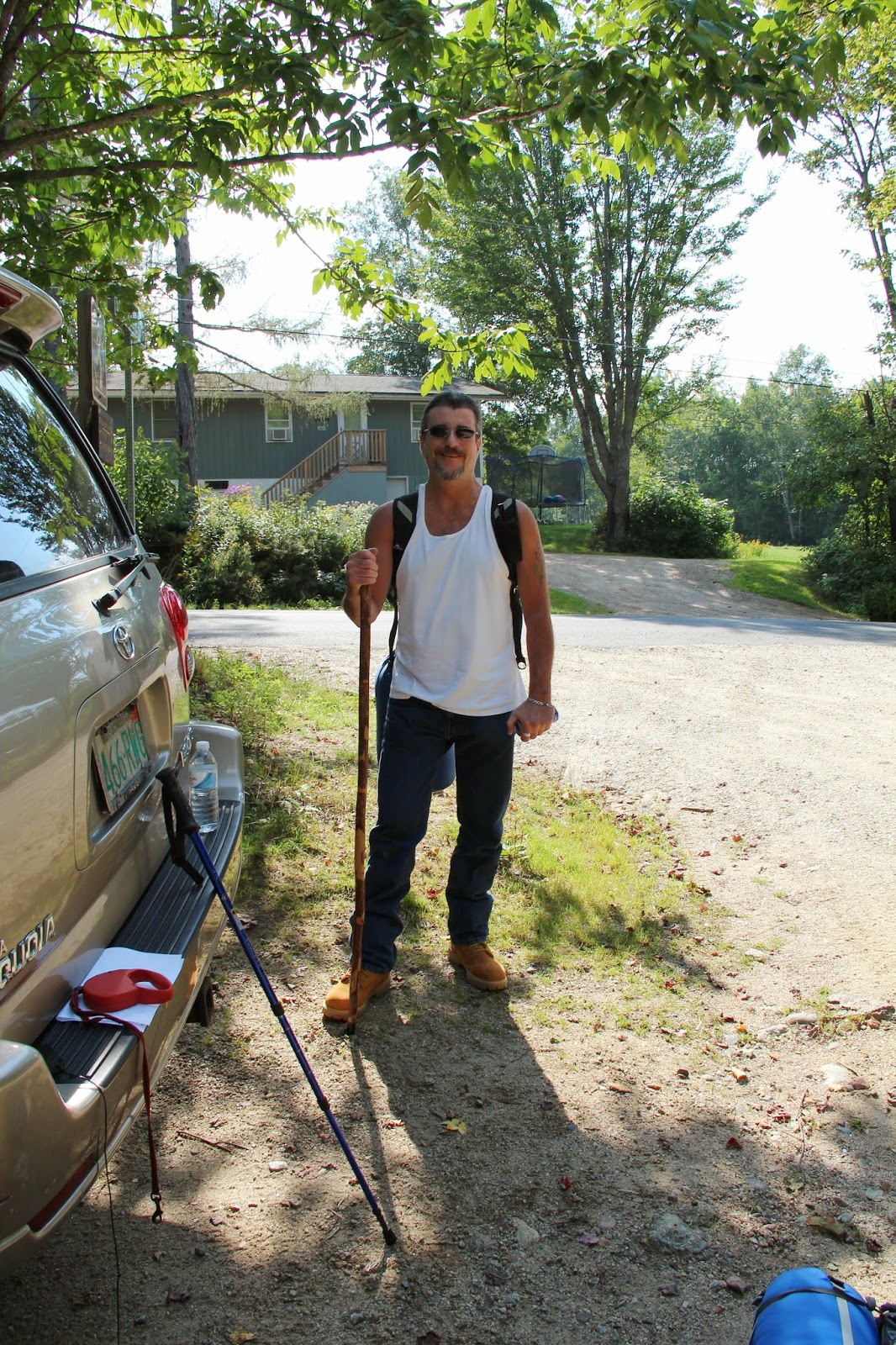
My brother ready to go

My brother looks very fit, however he has never hiked a mountain, ever…not even once.  He arrived at my house in jeans, work boots, a ‘school-like’ backpack and 3 cans of seltzer water.

Uh oh.. 

I couldn’t convince him to borrow my husband’s hiking pants or a hiking backpack but I did switch out his water.  He was now carrying 64 ounces of noncarbonated water. 

I decided to take him up the New Path trail.  I knew it was steep but didn’t realize the trail climbs 1500 feet in one mile.  There is also a long section of loose shale adding to the challenge.  This was not a good choice for someone who has never hiked!  When we reached the steep section of the trail my brother told me he didn’t think he could do it.  He was very shaky.  I encouraged him to drink water, eat dried cranberries and pecans.  He felt better and we continued slowly up the trail.  The heat and humidity started to take its toll on him.  His pack weighed 25 pounds.  I took his pack, sliding my arms through and comfortably balanced it on my pack.  My intent was to take it for 5 or 10 minutes but it was surprisingly doable so I kept it.  Taking the pack was a big help to him and with frequent stops, lots of water and trail food, I knew he would make it.

When we reached the summit of South Doublehead the look of relief, joy and sense of accomplishment on my brother’s face was incredible!  We took some celebratory photos and set off to the North Doublehead cabin.  Staying in a log cabin on a mountain summit overnight, enjoying a sunset and sunrise, was a great way to get to know my brother again.  It was even more special knowing how much it meant to him.   We spent some time reading the log books and he was happy to point out that he wasn’t the only one who thought it was a ‘crazy difficult’ hike.  He also pointed out that it would have been nice if I had chosen an easier ‘1st mountain’ hike.  Point well taken.

My brother on South Doublehead
After drinking coffee, watching the sunrise, and photographing orb spiders the size of small dogs, we descended the Doublehead Ski Trail. On the way down my brother became dehydrated. He had finished the last of his water at breakfast and needed more.  I had some extra water but I always carry a Sawyer Mini Water Filter in my pack.  I never needed it until now. After two bottles of nice, cold, filtered water from the brook, he was a new person!  

I often think about the things I carry in my pack and say to myself, “I’ll probably never need this but I’ll carry it anyway”.   Today I realized it’s better than ever having to say, “I wish I brought it”.

We got back to the car and swung over to the East Pasture XC Trail for a quick peak bag of Black Mountain-Middle Peak.  On the drive over we saw a mother bear and two cubs cross the road ahead of us.  My first cub sighting!

The East Pasture XC trailhead is located on an unpaved section of Black Mountain Road.  At the start of the dirt road there is a sign that says, ‘Unmaintained road. Travel at your own risk”.   If you don’t have a 4-wheel drive vehicle, I don’t recommend driving up this road.  Just park at the beginning of the dirt road and hike in. We drove down the dirt road and parked at a small pull-off area large enough for 2 cars - directly across from the XC trails sign.  Do not block the gates.

My brother stayed back in the car to get some much needed sleep while the ERD and I set off.  East Pasture trail is a very easy, seldom used trail.  Although it is overgrown in some sections, it is a nice beginner trail.  I told my brother this when I got back to the car but quickly added the views were much better on South Doublehead ! ;).  


35 down 17- 52WAVs to go.

Will need a redo on South Doublehead  - apparently the official summit has 2 cairns, not one.  
Me and the ERD on South Doublehead

The cast iron stove in need of a flue cleaning!
                                                               

Sunlight reflecting off the ERD's fur
 Yoga practice on North Doublehead before sunset.  Eka Hasta Urdhva dhanurasana
 Viparita dandasana with bent legs
 Eka Pada Urdhva dhanurasana 
Sunset on North Doublehead
Moonrise on North Doublehead
Amazing Sunrise on North Doublehead
North Doublehead Cabin 
Sunset reflecting off the window of North Doublehead cabin
Inside of North Doublehead Cabin
giant orb spider living on the outside walls of the cabin!
Doll's Eyes, White Baneberry (poisonous)
North and South Doublehead seen from the East Pasture XC Trail
 

ERD on East Pasture XC Trail
Black Mountain Middle Peak Views  "The recognized highpoint is atop a large rock in a fairly open area.
Logs indicate 360 views but this time of year, that's definitely not the case.  
Vertical profile for Black Mountain Middle Peak  

Yoga practice on North Doublehead summit

Saturday, August 30, 2014

Photo Blog - Precipice Trail, Bar Harbor, ME

I had heard a lot about this trail and knew I had to hike it when I got to Bar Harbor. Although I didn't find this trail physically challenging, I do have a healthy fear of heights and it did mess with my head in certain sections.  I felt myself gripping onto the metal bars much harder than necessary.

The trail starts with a meander through the woods and, about 20 minutes in, you come to the first set of bars where you have to pull yourself up and over. At this point, there are two sections where you have to climb or hop across large, rather sharp, boulders.  You also have to climb under and through two small 'caves' that are ten feet or so in length. They are an easy crawl through and one of them you can actually stand up in.

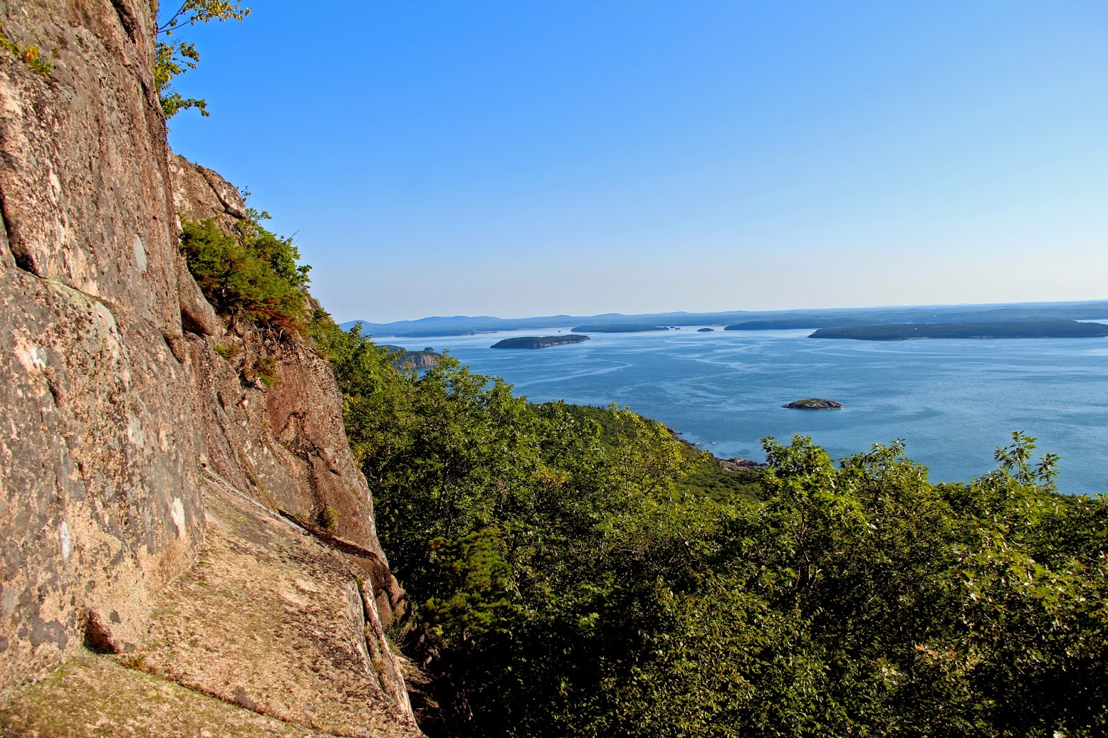
It doesn't really test your fear of heights until you get out of the trees and onto the bare ledges. This is when you get some beautiful views of the Porcupine Islands.  There are some damaged (and a few missing) bars along the way, but the rocks have some great areas to place your feet and pull up with your hands.  I don't think it will cause the average hiker too much trouble.   At the top I was surprised to find a shallow pool of water teaming with frogs!

It was a great trail to help prepare me for more challenging vertical climbs and I will probably visit it again then next time I visit Bar Harbor.

Caves - crawl throughs

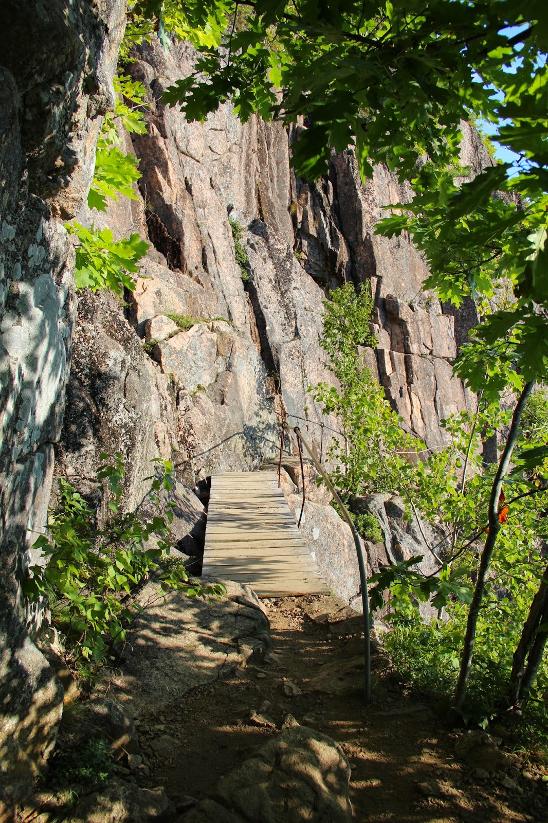
Bridge near the beginning of the trail


Bars to small ladder
There is a narrow ledge and you hold onto the horizontal bars to help keep you from slipping.
This bar helps you pull yourself up from the ladder seen on the bottom right of the photo.

Beautiful views of the Porcupine Islands
 
View looking down 

You hold onto the horizontal bars on the left to keep you from slipping off the narrow ledge.


You can see some bent bars here, some are a little shaky.  There are a couple of broken ones here as well. A little caution will keep you safe.
The bars here are to keep your feet from slipping off.  You can see the hand bar on the top left.

Near the top of the trail.
A view from the top.  Just beautiful

Virabhadrasana III (Warrior III pose) because I felt like one :).
A seemingly permanent body of water at the top! 

Teaming with frogs!

A fat frog hiding in the grass.


Friday, August 15, 2014

Woman makes plans God laughs... North Percy Peak

If you go into a hike with a ‘fixed set of plans’ you’re apt to be disappointed.  I always make a fixed set of plans but with an expectation of change.  When people ask me what my hiking plans are I tell them but add, “That’s my plan and I’m sticking to it, unless I don’t.” There are so many elements that can’t be controlled.  When the universe is on your side, things go as planned.  When it isn’t, you change them and add an adventure to your day.

I left at 8:00pm after my class to drive to Stratford, NH with the intention of hiking North Percy Peak, the South Peak and Sugarloaf the following morning.  I reserved a small cabin for the night.  It was pouring rain and I had a 3 hour drive. I’m not the best driver in good conditions and a tentative driver at best in the rain.  In a 65 mph zone, I drove only 45 mph annoying everyone behind me.  I am especially nervous at the 34A, B, and C (Cannon and Lafayette) exits; the narrow winding lanes in heavy rain, at night, are enough to send me over the edge literally.

I arrived 30 minutes late but the owner Judy waited up for me.  She ran out of her cabin in the rain, holding a flashlight, to tell me the power was out because of the storm. Ugh.  I had expected a warm cabin and a light to read by before I went to sleep.  Instead I had a cold, dark cabin with lightweight summer blankets.   


I used my headlamp and flashlight to illuminate the cabin. It was a neat, clean, minimally furnished cabin. The ERD was not happy, he is used to better, warmer, accommodations.  It was so cold in the cabin that I had to put on every item of clothing I had in my backpack including my raincoat, gloves and extra pair of socks. I was still cold. The ERD’s ears were ice cold.   

I woke up at 5 and checked to see that the power had been restored.  When I turned on the light I realized one of the windows was wide open!  No wonder it was so cold!  It was still raining.  It was dark and gloomy with no hint of sunshine. There was no service on my phone so I couldn’t check the weather.  Well, I didn’t drive 3 hours to go home without a mountain under my belt. 
Driving to the Trailhead


I fed the ERD, ate a banana and waited…nope, no change in the weather. I packed the car and headed off to the trailhead, maybe the weather will improve…nope.  I get to the trailhead, it’s raining. I start up the trail, maybe the weather will improve…nope. 

I hike up to the sheer, slanted, rock face.  I have read a number of trail logs saying you shouldn’t do this section of the trail in the rain.  I look up…yep, I can see why.  Water was running down the rock face, the fog obscured the way up to the summit.  Damn.  I sit.  I eat. The dog eats.  I made a decision, I’m going up.  I take off my backpack and put it on the ground.  I look at the surroundings to take note of where I am and where I am leaving my pack.  I take just my camera and the ERD and we scurry up to the summit. It was completely silent except for the rain.  I took a few photos and sat looking at the fog that surrounded me wondering if I would ever find my backpack.

Slippery slanted rock face to the summit
I took good mental notes, even with the fog, I was able to find my pack and headed back down the mountain.  I took my time, collecting edible hedgehog mushrooms, taking photos and drawing faces on quick-staining boletes.  I thought if I took my time on the descent, the weather would improve and I would head off to summit Sugarloaf….nope.  The clouds were still looming.

In spite of the weather it was a peaceful, silent (except for me occasionally talking to myself and the dog), and meditative hike.  It was just what I needed.  

drawing faces on quick staining bolete mushrooms
My pack was left right behind the 'side-facing person tree'


Eerie views 
Me and the ERD at the summit sign on North Percy Peak
Cort sp?
Coral fungus
Dryad's Saddle
The prized edible Hedgehog mushroom
Gills of unknown mushroom


Percy loop parking

Percy Loop trailhead sign

The fog enveloped summit of North Percy Peak 
climbing over roots to get to the summit
Hedgehog mushrooms with my breakfast