
This is the one I saw originally. It has doubled in size and is now about 3 feet deep. You can see how the old railroad ties are degrading and causing the ground to collapse. Someone was nice enough to put a stick with surveyor tape on it to alert drivers.

This is the second, new sinkhole. It's much deeper than it looks, close to 3 feet deep. Keep an eye out for them as you continue down the road.
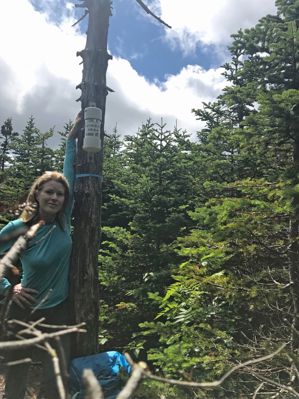
There is very good cell reception in the lot and on the trails. If you have Verizon, you will have no problem contacting anyone in case of emergency.
The weather forecast indicated a bright sunny day, and it was, everywhere except Redington. 😮

I had so much fear going into this hike. Rain, fog, an unmaintained trail, and an intense fear of getting lost on a mountain in bad weather... I wanted to cry. I knew I could do it. I had enough gear in my pack to survive any turn of weather, I just had to breathe and put my fear aside.
Donned with my rain gear I headed toward the herd path.
From South Crocker, head toward the view point. Just before the view, bear right onto the herd path. It took me a few minutes to find it, and honestly I walked in circles a few times just to make sure I was on the right path. It becomes pretty narrow here and I have a few scratches and bruises from branches smacking into me. Once you find it, it will take you to the boundary line. There are two broken trees here with surveyor tape on them. (Remember these two trees. The first time I attempted Redington, I didn't make a note of them and was lost for 20 minutes looking for the turn back onto the herd path.)


Take a right onto the boundary line. Follow it a short distance to where there are logs piled up across the boundary line. (Do not do what I did the first time, do not walk over the logs and continue down the boundary line!) Turn left and continue onto the herd path back into the trees. You will see bright surveyor tape marking the way. It is narrow, but the path is well worn, and it is beautiful.

I marked a number of waypoints on my GPS to make sure I would be able to find my way back if I got disoriented. Other than being slightly nerve-racking in places, the trail wasn't too difficult to follow.
You will eventually get to an old road/snowmobile trail, turn left. Follow four surveyor tape markers to a small cairn on the right hand side. When you see the cairn, turn back into the woods. A worn path will lead you in the right direction.

You will follow the path to beautiful open fields. No one told me about this beautiful section of the trail filled with large, bright, edible bunchberries! The fear started to melt away as the sun broke through the clouds.


The path will take you to the summit of Redington. At the summit you will see a homemade wooden sign for Redington. Follow the path to the right (there will be surveyor tape leading you) about 15' to the canister on a dead tree.
There are a number of short videos showing the Redington herd path on my Facebook page. You can view them here: Redington herd path videos
Helpful info written by Brian Tausendfreund on NETC: "When you come down, you will come to a Y in the trail. Bear left! You will eventually come to another Y in the trail. Bear left again. Continue on the herd path back to S. Crocker."


No comments:
Post a Comment