Monday, June 15, 2015

Mount Mansfield, VT

Loop Hike:  Route 108, Long Trail South, Summit Ridge Trail, Toll Road, Haselton Trail   

My husband and I planned a weekend in Burlington,VT and of course I wanted to climb the highest peak while we were there.  So Saturday morning we packed our gear and headed for the mountain. My husband brought his CamelBak pack, a couple of snack bars, and not much else. I had enough in my pack to cover almost any emergency, everything from bivy sacks to firestarters. My husband shook his head.

We parked at the Smuggler's Notch Parking area and walked the half mile to the Long Trail South trailhead.  It's a beautiful trail.  The heavy rains, from the night before, left behind streams of running water on the trail. The water brought out a shimmer in the rocks. The deeply striated rock shone with gold and silver flecks with each step. I saw similar rocks on Mount Meader and I decided to find out more about them.  I found an old PDF file about the "The Geology of Mount Mansfield State Forest."  Just in case anyone else out there (besides me) is interested these rocks; they are are called, "mica-albite-quartz schitz".    http://www.anr.state.vt.us/dec/geo/pdfdocs/Parks/Christman_1956_MansfieldPark.pdf.


Left: Mica-Albite-Quartz schitz, Right: Mica
As my husband hiked ahead, I meandered up the trail enjoying the flowers, cool air and the deep green of the woods. Vermont is truly the Green Mountain state.  When my husband stopped ahead to wait for me, he noticed I was eating something.

  What are you eating?
  Trillium.  
  What?   
  Trillium, it tastes like arugula and spinach.  You want some? 
  Uhm, no.
  Well you should look at the plant so you can identify it without the flower.  
  Why? I only hike with you.  If I'm starving in the woods you can show it to me then.
  Haa :).

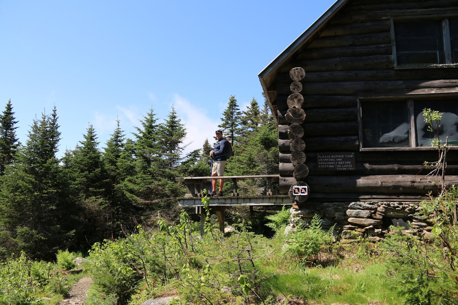
The Taft lodge was very cool.  It is such a great place for a hiker to spend the night.  I wish I had thought about staying there.
eka pada urdhva dhanurasana on the Taft Lodge bench.
The trail is steep gaining 2,793 feet of elevation in 2.3 miles, but I really enjoyed it. No annoying switchbacks, just straight up fun.  The last 2/10 of a mile involves a considerable open rock and ledge scramble.  I love scrambles and was happy to see my husband enjoyed discovering his own inner billy goat.   I don't recommend hiking down this trail when it's wet.  If you're wary of open rock scrambles, take an alternate trail up.

 The summit is absolutely beautiful with 360 degree views that reminded me of Katahdin.


360 views on the Chin.
We hiked across the ridge as the clouds swirled in around us.  My husband mentioned he didn't have a raincoat if it started to rain.  I smiled knowing that I had an emergency poncho in my pack for him if the weather turned  (1 point for me).  But the weather held out and cleared as we hiked toward the Nose.

The trail to the Nose is closed right now so we started toward the Haselton trail. When we reached the ski slope, the black flies and mosquitoes attacked ruthlessly.  I pulled out my bug net and put it on my head. My husband was swatting black flies furiously, looked over at me with my head net and frowned.  I pulled out an extra one for him (2 points for me).  I grabbed a bag of dried cranberries and walnuts. Again my husband looked at me and frowned.  I gave him 1/2.  (3 points for me).  I pulled out a granola bar, gagged, looked at the expiration date, June 2012 (1 point for my husband).  Note to self:  check expiration dates of food in pack :D.
Haselton trail is much less steep and an easier way down so I planned the perfect loop.  Since my husband only hikes with me 2 or 3 times per year, it's nice to have it go relatively smoothly :).  In the end he admitted that I packed a good backpack. (score: me 2, husband 1).

For a detailed log of trail conditions: http://www.newenglandtrailconditions.com/vt/viewreport.php?entryid=21558
Ski slope to Haselton Trail


Most likely green frog eggs. Notice tadpole larvae clustered at the top of the egg mass.

The Nose - trail to the summit of the Nose currently closed.
Vernal pool on Toll Road on the way to Haselton Trail

Where's the hubby? 

Where the trail becomes fun :)

Summit area of 'The Chin"


Saturday, June 6, 2015

Eagle Crag & Mount Meader


I headed off at 8:30 pm for the three hour drive to the Baldface parking area.   I wanted to be comfortable sleeping in my car so a grabbed the spare full-sized mattress and put it in my Sequoia.  Yes, a full sized mattress fits in my Sequoia.  I had my sleeping bag, a couple of wool yoga blankets, a pillow and a cooler of food.  Voila, a mini house on wheels.  The ERD slept in his bed in the front seat and, since the food was in an impenetrable cooler, I had no food stealing incidents in the middle of the night.  As I am typing this, the ERD is snoring loudly.  I can't believe how such a loud snore can come out of a 10 lb chihuahua.  Thank goodness he didn't snore like that during the car camp!

There’s only one problem with car-camping (besides snoring, food stealing chihuahuas), you can't check the weather forecast before you set off for a hike.   When I woke up there was a thick, gray overcast. It was damp and cold, but it wasn’t raining.  So, to cover all my bases, I set off with enough hiking gear in my pack to survive an Indian monsoon.

The Baldface Circle trail is a not a very exciting trail. It’s a monotonous meander under deep tree cover, without views – until you get to the last half mile - then it becomes exciting.  The last half mile is very steep, slippery rock face. The last quarter mile is a rock scramble.  A wet, slippery scramble, making foot and hand placement a little tricky.  The ERD darted right up and looked down at me wondering what was taking me so long.
Looking up
Looking down!
When I reached the top I was surrounded by a warm, heavy fog.  It was completely unexpected.  It was a cold, damp hike all the way up and I thought it would be colder when I cleared the trees.  Usually, when the weather is foggy I don’t stop – I keep moving so I don’t have to layer up. But the fog was like wearing a warm blanket and I sat on Eagle Crag for a while catching glimpses of white-throated sparrows darting about making their “chip-up” call.  http://www.allaboutbirds.org/guide/White-throated_Sparrow/sounds.  They are beautiful birds – take time to notice them!


I continued on the Meader Ridge trail.  I expected it to have more views, but most of the two mile trek is under tree cover with occasional peak-a-boo views.  When I arrived at the Mt. Meader viewpoint, the fog had evaporated and the views emerged.  I was in no hurry so I spent a lot of time just hanging out enjoying the weather change.  The ERD seemed to be enjoying the leisurely pace.  
The ERD stole my cheese and knocked over his water cup.
I had no issue with bugs the entire hike until I got to the Meader Ridge/Mt Meader/Basin Ridge trail intersection. I stopped to feed the dog and was engulfed by black flies!  Well, not really engulfed, but there were a lot of them! There were also quite a number of yellow jackets on the top portion of the Mt. Meader trail. I had no issues with them but for people with allergies, you may want to keep a close eye out.   Apparently, mosquitoes love the Mt. Meader Trail.  There were so many mosquitoes, that even with a bug net, I abandoned my plans to take the side trail to check out Brickett Falls!

Mt. Meader Trail is less steep than I expected, not a bad way down. It's an easy road walk back to the parking area.  For more details on trail conditions during the hike: http://trailsnh.com/URL/68257 


Clintonia borealis (blue bead berry).  Interesting plant pollinated by flies.


Saturday, May 2, 2015

Mount Parker: Uphill both ways

View of Mt. Washington from Mount Parker Summit

I was apprehensive about this hike.  Everything I read said this a long, steep hike.  In the logs, hikers agreed that Mt. Parker would be a more popular hike if you didn’t have to ascend and descend the Oak Ridge/Mt. Parker col twice. The 2800 feet of elevation gain combined with the 7.8 mile roundtrip is much greater than a number of popular 4k footers.  

In addition, spring hiking is a crapshoot.  You just never know what to expect, so I planned for the worst and brought everything; snowshoes, spikes, and bad weather gear.  I was pleasantly surprised. The weather was great and the trail was much easier than expected. Personally, I enjoyed Oak Ridge and I didn’t feel it was too steep, coming or going.

The Langdon Trail, was mostly dry except for some easily avoidable muddy sections.  Water crossings were either walk overs or rock hops on the lower elevations, no water on the higher elevations so bring water for your dogs.

At 1.5 miles in, the trail was so dry I decided to abandon my snowshoes in a hollow log and covered them with leaves.  The ERD must have thought I hid some food in there because when I turned around to check on him, he was inside the log kicking out all of the leaves!
The ERD
There was very little snow until 2500 feet.  After that there was a consistent, considerable layer of snow until you reached the summit.  Nothing challenging, I just walked in another hiker’s old postholes.  I bare-booted it all the way up, no spikes needed. 

The trail is narrow and hard to follow in places; trail markers are faint and not well maintained.  Just keep an eye out for faded markers on trees and rocks.  It can be especially confusing in the areas where fallen trees are blocking and obscuring the already narrow trail.  There are a number of fallen trees blocking the trail starting around 2200 feet.  Even so, I made good time getting to the summit – much quicker than anticipated. 

The views took my breath away!  The ERD and I stayed for an hour basking in the sun and soaking up the views.   I was the only one on the summit and didn’t see another soul until my hike down. I highly recommend hiking this trail before the snow melts on Mount Washington!  It was a smooth hike all around – which is unusual for me – makes me wonder what’s in store for me on my next hike ;).

FYI, I stayed at the Swiss Chalets Village Inn, Bartlett.  It’s clean, very reasonably priced, and they take dogs!  

44 down 8 to go.  


Roundleaf yellow violet wildflowers
Mourning Cloak Butterfly


Monday, April 13, 2015

Firescrew Mountain

The ERD happy to be on the trails again - even with his allergies :)
I needed to be on a mountain.
I didn't care what mountain as long as it had a view and the Trailsnh report didn't have the words 'no fall zone' in the description.  I also didn't want to hike anyplace where full grown pines looked like stunted shrubs still deep in snow.  I settled on Firescrew Mountain.  I've been to Cardigan, twice...both times I was surrounded by fog and I never made it to the other side of the mountain.  

The road leading to the parking area is a muddy mess.  A squishy, slippery, deep-rutted mess.  I did okay with my truck and the parking lot was filled with small cars, but a little caution would be wise.

I hiked the Manning trail. It's a beautiful, meandering trail, moderately steep after 2200 feet. There are soft, slippery, icy patches here and at about 2700 feet. It wasn't bad going up, but it was definitely a challenge getting down. I wore my Hillsound Trail Crampons, but with the wet snow and mushy ice, I don't think they helped much. I didn't posthole often but when I did, I went full-leg deep. I recommend caution when you get to the large glacial erratic, you can hear quite a lot of water running underneath the trail. With the warm weather you don't want to be the one that drops through. 

Signage was very good, even toward the top. The cairns have popped out of the snow making the trail easy to follow.  It was a beautiful day to be on a mountain.  On the way down the ERD and I spent some time on the ledges, out of the wind, enjoying the views and basking in the much needed sun.

Happy spring...finally.


The ERD relaxing on my legs, out of the wind, and soaking up some sun
The ERD and I were in no hurry to go down.
The ERD and a view