Sunday, July 5, 2015

Sugarloaf Mountain, Nash Stream Forest

After an early morning sunrise on Mount Magalloway, running on no sleep and no coffee, I set out to meet the infamous Mike Cherim and Bill Robichaud to help them out with a car spot.  We were going in the same direction but to different peaks.  I was hiking Sugarloaf and they were committed to a long day of redlining starting with Percy loop.  The ERD jumped right into Mike’s lap and made himself comfortable.  The ERD likes hikers.
Mike & the ERD
Bill in the back
The Sugarloaf trail shouldn’t have been hard to find, but it was. I kept driving on Nash Stream Road thinking I had gone too far and would backtrack looking for the trailhead.  I finally realized my mistake. To find the trailhead, drive past the Percy Peaks and Percy Loop trails and keep going, and going, and going until you drive over a small bridge. On the left you will see a CT Cohos Trail blaze, a 2-car parking area that looks like private property, and a house set back on what looks like a private driveway. This is the trailhead.  If there is no room in the parking area, just park along the road.


This was a surprisingly easy hike. Before I hike, I make a mental note of how long it should take me to reach a summit.  Generally I plan on an hour per 1000 feet of elevation, and then pad it.  So, with an elevation gain of 2700 feet, I figured it would take me around 3 hours to get to the summit.  I reached the summit in 1 hour and 40 minutes. 

The trail is wet and muddy near the beginning and continues to be wet until you reach approximately 2200 feet.  Even with the mud, the trail has easy footing.  From here the trail is dry and continues to ascend gradually with little bursts of steeper sections.  At 3,200 hundred feet there are a couple of brooks for dogs, but no water at the summit.

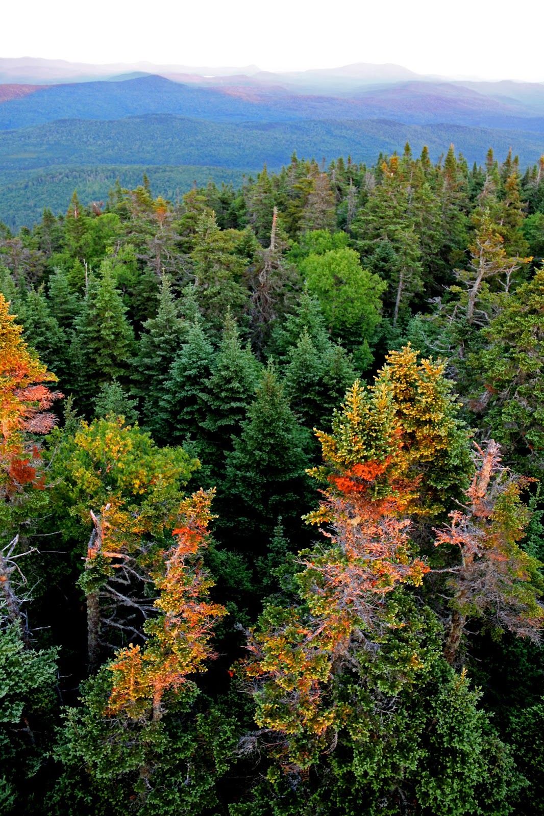
I was surprised by the summit.  It was beautiful!  Keep going past the benchmark to reach jaw-dropping  mountain views.  

There was another hiker at the top; the ERD found him first.  He must have smelled food in his pack.   We chatted for a while, then I wandered off to take photos, and sat enjoying the views before heading back down.  The footing was good going down as well, it only took an hour to get back to the car…which was covered in butterflies!

The only one that didn't fly away when I reached my car.  A White admiral butterfly Limenitis arthemis
It was a relaxing hike with beautiful views, just what I needed.

 ****

Then there were 2 …

Morning fog on the way
A beautiful moon and low fog on my way.
Fog on Lake Francis
White admiral butterfly Limenitis arthemis
A cow and I having a conversation along the side of the road
ERD on the summit

A random stove at the summit
Remains of what looks like an demolished cabin
Summit benchmark
A fallen summit sign
Summit views


 Eastern tiger swallowtail (Papilio glaucus) pollinating blue bead lilies

trail beginnings

Saturday, July 4, 2015

What can I say about Magalloway?

Magalloway Cabin from the fire tower
It’s a long, long drive from Massachusetts.

If I'm going to drive that far, I'm going to stay in the Watchman’s cabin. https://www.nhdfl.org/Natural-Heritage/Fire-Towers/Watchman-Cabin-Rental  Originally I was going to hike this mountain last; I would finish with an easy mountain and my daughter would come with me to celebrate. 

When I brought this up to remind her, she told me (in a sassy, melodramatic way that can only come from the mouth of a 16 year old girl), “Oh God! I can’t think of anything else in the world I would rather do less than hiking a mountain and staying overnight in a cabin, in the woods!” 

Telling her that there was no electricity, no cell phone coverage and I would be cooking dinner on a wood stove did not help my case.

Okay, change of plans, I would save Stairs and Resolution for my last 52WAV hike.  I needed a less challenging hike after Shelburne Moriah, so I decided to hike Magalloway and combine it with Sugarloaf the next day.  

The trailhead is located on Magalloway Road. Turn right at the Magalloway Tower sign and follow the road until it ends. 

The Coot Trail is short and not too steep for anyone who is reasonably fit.  It’s eroded in places and a muddy mess at the beginning of the trail, but I was on the summit in under 30 minutes.  I watched a number of people visit the summit during the afternoon.  The comments ranged from, “OMG that was tough” to “Nice easy trail”, to “I can’t believe I made it.”  
Coot Trail
There are three viewing areas. Most people only know about the tower views. You are missing out if you don’t check out the other two.  The Overlook Trail is a short walk to some unexpected ledgy views.  

The other viewpoint is right outside the cabin. Walk past the fire pit and there is a beautiful place to sit and watch a sunrise come up over the mountains.

There are a few things you should know about the cabin if you plan to stay there.  The cabin is advertised as having a working woodstove and a screened-in porch.  If you go with visions of sitting and reading your favorite book in the screened porch, or being warmed by the blazing fire in the wood stove, you will, 1) be staring at woodpile in the dark storage area (AKA screened-in porch), and 2) freeze half to death because they have closed off all but the top cooking portion of the stove. 

guilty pleasure
The wood storage AKA screened-in porch
Thinking I would have hours of warmth with the wood stove, I did not bring my sleeping bag.  I thought my multi-layering of cloths (wool tank, wicking tee, long sleeve Smartwool shirt, heavy duty Smartwool jacket with hood, Northface raincoat, extra wool socks and gloves, etc.) would be enough.

The temps dropped into the 30’s – I was not warm. Then, I had what I thought was a great idea! 

 Note to self:  An emergency bivy sac does not double as a sleeping bag.

If you do this, you will fall asleep toasty warm thinking you had a great idea.  Then you will wake up soaking wet, chilled to the bone from your bodyheat being turned into water droplets trapped on the inside of the sac.  

Deciding I was too tired to do much about it, I turned the sac inside out. I looked at the ERD, he looked at me, he walked across the bed, walked into the sac, curled up into a ball and went to sleep on my lap.  Warm enough to get another 40 minutes of sleep.

Got up at 4:20AM,  packed my gear, and went to watch the sunrise over the mountains.   By 5:20 I was walking down the mountain and off to my next adventure.

I would stay there again…with a sleepbag next time.  It was a beautiful place to spend a night.


***
And then there were three.

The ERD enjoying his surroundings
Viewing platform on the tower

The ERD wanting to join me at the Fire Tower lookout
dense woods below
Sunrise on the trail past the fire pit
Sunrise on the lookout point past the fire pit

Tree pose between trees on the Overlook Trail

Utthita Trikonasana on the Overlook trail
Almost blew up the cabin with this propane lamp. Really...
There is a natural spring, down the hill to the right of the log pile.
The ERD going back to the cabin from the spring
trail to the natural spring is to the right of the log pile
Only the small section at the top can be used for cooking. The rest of the stove has been permanently wired shut.

just a tiny fire for cooking - not enough to keep you warm!
The kitchen - I did have some of the wine left behind by the last hiker ;)
the kitchen/writing table
Me enjoying my outdoor fire, food, and a little wine :)
About the cabin
Overlooks and nearby sights
Cabin locks
The Cabin 
someone left a teddy bear hanging from the ceiling
The ERD wondering why he is in this cabin. The intense stare wants answers. 
Sleeping arrangements